METRONow
Mobility for All

METRONow
METRONow focuses on meeting customers and communities where they are today and earning the right to grow through tangible initiatives that enhance the customer experience.
Priorities:
Safety Cleanliness | Reliability Accessibility |

Our Progress and Future Plans
Find out what we've accomplished and what's next as we continue implementing the METRONow plan.

We took several steps to strengthen safety across the system, including:
- Reaching full METRO Police Department (MPD) staffing within Chief Tien's first year, increasing the number of sworn officers by 26%
- Expanding law enforcement presence across the system through partnerships with the Houston Police Department, Harris County Sheriff's Office and Harris County Constables' Office
- Upgrading dispatch and records technology, improving coordination with local law enforcement, and speeding up response times during incidents
- Launching a 24/7 language interpretation service so officers and dispatchers can communicate more effectively with people who have limited English proficiency
- Opening MPD satellite stations at Wheeler Transit Center and Northline Transit Center to increase on-site officer presence, improve response times and strengthen safety in key areas of the system
- Adding fencing and lighting at select METRO transit centers to enhance safety and security where additional measures were needed

We expanded cleaning and maintenance efforts to improve system upkeep and rider experience, including:
- Increasing cleaning frequency at bus stops, from three days per week to five days per week at various locations and to daily at high-volume locations across the system
- Partnering with local management districts to clean and maintain bus shelters in their communities
- Launching a rapid response program to address concerns that require immediate attention
- Adding additional train cleanings at the end of METRORail lines to help keep trains clean throughout the day
- Investing in six street sweeper vehicles to maintain roadways along rail lines and key bus corridors
- Expanding landscaping services to support safer, well-maintained transit facilities and stops
- Implementing landscaping and refreshed plantings at Stadium Park/Astrodome and TMC/Dryden rail stations, and at Fannin South Transit Center
- Enhancing systemwide cleanings, shading and safety improvements

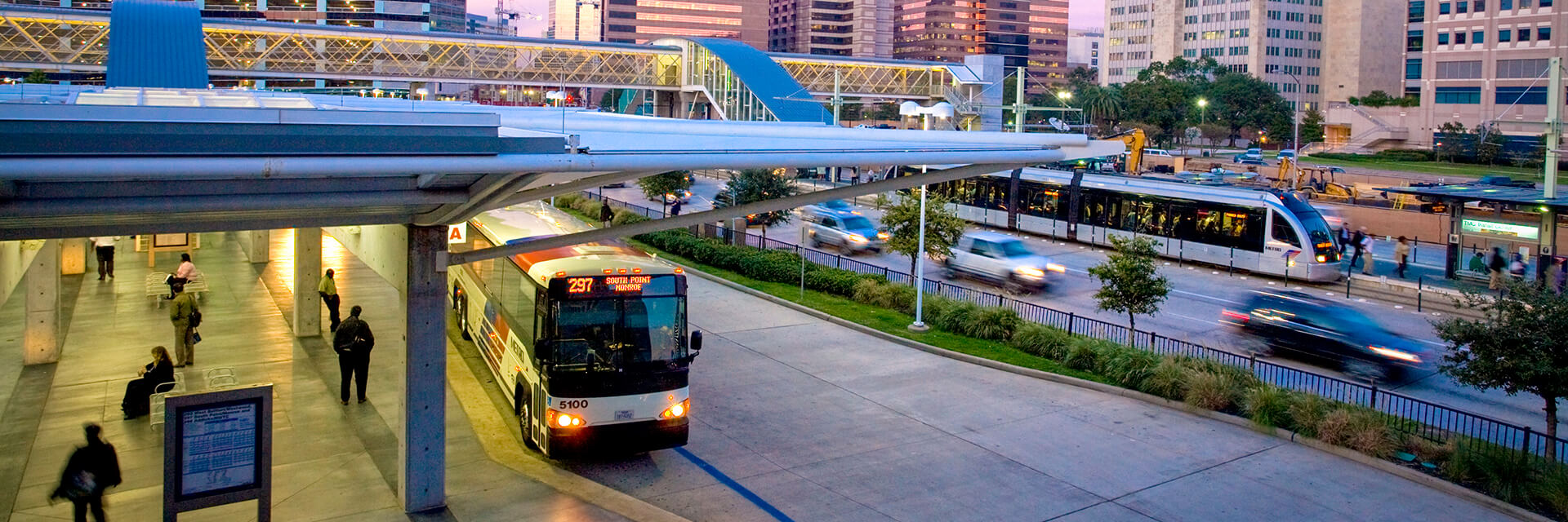
We made several investments to increase service reliability and improve the customer experience, including:
- Launching the 500 Downtown Direct, providing a direct connection between Downtown Houston and Bush or Hobby airport
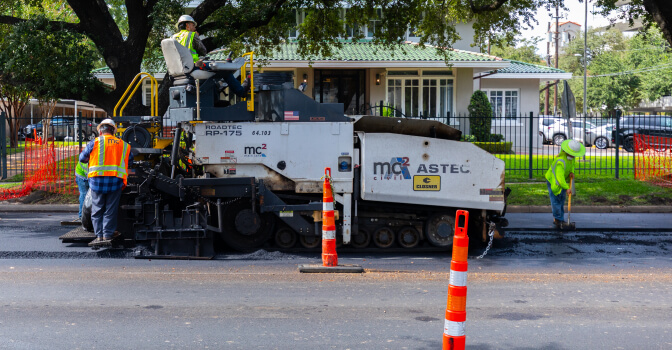
- Completing 125 lane miles of roadway along key corridors, including Washington Avenue, Westheimer Road, Montrose Boulevard, Kirby Drive, Post Oak Boulevard, Harrisburg Avenue, Hillcroft Avenue, Braeswood Boulevard, West Gray Street, Bellfort Avenue, Jensen Drive, and East 20th Street
- Upgrading the bus fleet with modern, clean diesel vehicles that reduce emissions and provide a more comfortable ride
- Opening the new Missouri City Park & Ride facility, featuring over 1,700 covered parking spaces
- Expanding Community Connector service to Downtown, Near Northside and the Heights
- Expanding customer service hours to better support riders

We expanded accessibility improvements across the system, including:
- Completing 20 miles of sidewalk improvements along Washington Avenue, Westheimer Road, Kirby Drive, Post Oak Boulevard, Scott Street, Antoine Drive, Harrisburg Avenue, Hillcroft Avenue, Braeswood Boulevard, West Gray Street, Bellfort Avenue, Jensen Drive, and East 20th Street
- Adding two new METRO curb2curb zones in the Sunnyside and Kashmere/Maxey Road communities
- Partnering with Uber and Lyft to help provide METROLift and curb2curb rides during high-demand hours
- Launching the METRO On Demand app, allowing METROLift and curb2curb customers to schedule and book rides more easily
- Installing over 1,200 new shelters along local bus routes
- Upgrading 5,600 bus stops to meet or exceed universal accessibility requirements